
Knocknatobar


On Sunday August 25 the club walk was on Knocknatobar mountain. Situated north east of Caherciveen. The mountain stands against the prevailing south west winds that carry rain in from the Atlantic. Fresh water springs out of the ground in many places, giving the mountain it’s name Knocknatobar ( Hill of the Wells ). Rising to 690 meters its the 32 nd highest in Ireland. At the foot of the mountain is a holy well called Saint Furseys which is reputed to have a cure for eye complaints.
Leaving town at 08.30 we made our way westwards. The day was dry. We stopped in Glenbeigh at the Towers hotel for some tea / coffee and also managed to get a scone eventually. Arriving at our destination we put on our gear, our route was the pilgrimage path to the summit. This has been a place of pilgrimage for millennia, from pre Christian Era to present time. In 1884 / 1885 the fourteen stations of the Cross were erected along the path that zig zags to the summit. A large cross and altar were erected on top at the behest of Canon Brosnan of Cahersiveen in 1884.
The path traverses the western flank of the mountain. As we gained altitude the views opened up. Caherciveen to the south west with Valentia island and the Skelligs.The Blasket islands and Dingle peninsula to the north with the sparkling waters of Dingle bay in between. Conditions under foot were good, but wet in places as could be expected, after all it is the Hill of the Wells. It’s a steady but not too demanding climb to the top.
Towards the summit we  got some mist and donned our rain gear.  Visibility was poor as we climbed the final steep slope to the top. Here we rested up and had refreshments sheltering at the side of the substantial altar...
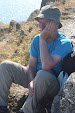
 Refreshed we decided to continue eastwards along the ridge..to our left were gaping cliffs tumbling down to the valley floor. We went on a few hundred meters in poor visibility..then like a curtain being pulled aside the mist lifted and we were treated to fantastic views..the Glendalough lakes hundreds of feet below... and the Iveragh Peninsula all around. It was ample reward for the effort.... We then retraced our steps and eventually reached the car park...well done to everyone. Also it was good to see some new faces..some made a stop at the Towers for refreshments on the way home..
It was an excellent day out and a route that will be repeated, next time hopefully continuing on to a Kells....

  “ To find a mountain path all by oneself gives a greater feeling of strength
          than to take a path that is shown “.  ...............Karen Horney


Comments

Popular posts from this blog

The Claragh Loop

 The Claragh Loop is a great walk in North West Cork near Millstreet,   for our Club and our members it is not that far away and in some ways for us it is so close most people never bother doing it, thinking the far away fields are greener.  We use it as a Club Walk once a year but our members often use it go for a walk by themselves or in a small group regularly just to get out for a bit of fresh air or excercise.   To get there you go into Millstreet, turn down the road between Centra & the Church and travel out the Clara Rd. going past the turn off for the Mount Leader Industrial Estate for about a mile until you meet a Grotto and just beyond this you park on the right on the bend. If it is busy around here you may have to go back down to the Clara Rd. and walk back up,  You then proceed to walk up the small road on the town side of where you are after parking until you meet the entrance into the forest on your right . This is the start of the Claragh Loop.You then proceed up

St. Finbars Pilgrim Route -Kealkill To Gougane Barra

On Sunday 8th April the club walk was the Kealkill to Gougane Barra section of the Saint Finbarr’s Way. After leaving town at 09.15 we made our way to Gougane Barra, where we had coffee and left a car with our change of clothes. We then continued to Kealkill to begin our walk. As it was Pilgrim Path week the car park was full so we had to park in the village. We started at Carriganass  ( Rock of the waterfall ) Castle. This castle was an outpost of Donal Cam O’Sullivan Beare. After the battle of Kinsale in 1602, having lost control of his strongholds in Dunboy and Dursey. He led his band of 1000 followers past this castle in mid winter, on a tragic journey to Leitrim. Attacked by both Irish and English on the way only 35 arrived in Leitrim 14 days later. We continued up the road past the castle climbing all the way. After after a little Bantry Bay can be seen.  Two and a half kilometers later we leave the road crossing a stile on our left, climbing steeply towards Knockbreteen hi

Cumeengeera Horseshoe

Now that my biro has dried out the blog can finally be written. On Saturday 15 Sept. the club had originally planned to do the Gougane Barra loop,however it was changed to the Cumeengeera Horseshoe route. This is in the rugged Beara peninsula bordering Cork and Kerry. We set off westwards towards Kenmare on a dry morning. Arriving in Kenmare we stopped for tea / coffee, before heading through Lauragh and to the start of the hike at Shronebirrane stone circle. This is at the head of Rabach’s glen.  Called after Cornelius “Rabach” o Sullivan. Rabach means violent in Irish and Con earned his nickname well. In 1800 he murdered a sailor who called to his door one bad stormy wet night looking for shelter. He later murdered a woman who had witnessed the crime and had threatened to inform the police. Eventually he was caught and hanged in Tralee Gaol in 1831.... We climbed the Horseshoe in an anti clockwise direction. The weather was excellent but the climb was a thigh burning slog to reach t