
Moylussa & Logh Derg

On Sunday 5 th. May the club outing was to Moylussa in County Clare. On a lovely brisk morning we left town at 08.30 and headed to Limerick. Then on to the M7 turning off at the Killaloe / Ballina junction. Here we stopped at the Applegreen service station for tea / coffee. We then continued to Ballina crossing the mighty Shannon over the 13 arch stone bridge into Killaloe in the Banner county of Clare.Birthplace of Brian Boro 941-1014 high king of Ireland from 1002 until his untimely death at Clontarf in1014. Brian ruled Ireland from Killaloe which was effectively capital of Ireland that time. Another man born here was the legendary Keith Wood , Ireland captain, Munster and Lions hooker. Keith opened a coffee shop here in 2018.
Turning right in Killaloe we continued to the car park at Ballycuggarn Wood on the banks of Lough Derg. It’s claimed that the oak from this area was used to roof Westminister  Hall. Much of the oak was used for shipbuilding and to feed the fires of the iron furnaces. The oak forests are long gone.The name Ballycuggarn dates back to the 10 century and is called after the  O’ Cuggeran family supporters of Brian Boru.

 After changing into our hiking gear we crossed the busy road and proceeded on a path upwards under a canopy of beech. As we gained altitude the broad expanse of Lough Derg sparkled in the sun below us. Starting at almost sea level the climb is steep. The views as we climb are stunning.
Beech now gives way to Sitka spruce , Norway spruce , and Nobel fir. Part of this climb follows the East Clare way marked with the ubiquitous yellow man markers. ( One wonders how long before the PC brigade insist they be called the yellow person markers ).
We are now contouring the northern flank of Feenlea mountain. Eventually we leave the forest path and venture onto open mountain. After some time we came to a sleepered section which leads to a stone stating a height of 1748 ft. However apparently this is not the highest point. This is a little further on.
We decided to push on to the official summit at 532 meters.This turned out to be featureless. However there were panoramic views from here. Northwards Scarriff , Mountshannon and County Galway . To the west the Shannon estuary. Eastward the Arra mountains and the Silvermines. To the south the Galtees. We decided to have a break and refreshments here. Refreshed , with the weather so fine we continued south westwards to the summit of Cragnamurragh at 526 meters. Here we were rewarded with picture post card scenery. Proving that no county has a monopoly on beauty. Though clever marketing may try to persuade us otherwise. Here there is a trig point to mark the summit, unlike Moylussa. This trig point has an interesting history. According to the Dublin Evening Post in 1828 the local community of Glenomera helped the Ordinance Surveyors to build the trig station.
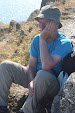
Apparently a large crowd ascended on the mountain “ Borne up by music from flutes , pipes and violins , and accompanied by young women carrying laurel leaves “. However the locals insisted in calling the trig point after Daniel  O’ Connell the Liberator. The Surveyors were not welcome in most places as the were representatives of the Crown,and were a branch of the military. Today there were no flutes or pipes or young women carrying laurel leaves.  We savored the views. There was a steep drop to the south. After relaxing here we retraced our steps north eastward. Skirting the summit of Moylussa we came to the plaque at the end of the sleepered section and proceeded down the mountain. Below us the Mediterranean blue Lough Derg was resplendent in the sun. We encountered many walkers on our hike. Young and old enjoying the sunshine. Finally we reached the car park. Again there were lots of people about enjoying the wonderful countryside.
We changed and it was decided to call to the Lake Hotel in Ballina for tea / coffee. There was a great buzz in the twin towns of a Killaloe / Ballina. People enjoying the Bank holiday weekend.
There was a slight mix up and some ended up in Flanagan’s and more in the Lake Hotel. However this did in no way spoil what was a wonderful day out. Everyone enjoyed a fabulous hike in glorious weather in the Banner county. These are the days that make it all worthwhile.


          “ A walk
          in nature
      walks the soul
        back home “.................. Mary Davis


Comments

Post a Comment

Popular posts from this blog

The Claragh Loop

 The Claragh Loop is a great walk in North West Cork near Millstreet,   for our Club and our members it is not that far away and in some ways for us it is so close most people never bother doing it, thinking the far away fields are greener.  We use it as a Club Walk once a year but our members often use it go for a walk by themselves or in a small group regularly just to get out for a bit of fresh air or excercise.   To get there you go into Millstreet, turn down the road between Centra & the Church and travel out the Clara Rd. going past the turn off for the Mount Leader Industrial Estate for about a mile until you meet a Grotto and just beyond this you park on the right on the bend. If it is busy around here you may have to go back down to the Clara Rd. and walk back up,  You then proceed to walk up the small road on the town side of where you are after parking until you meet the entrance into the forest on your right . This is the start of the Claragh Loop.You then proceed up

St. Finbars Pilgrim Route -Kealkill To Gougane Barra

On Sunday 8th April the club walk was the Kealkill to Gougane Barra section of the Saint Finbarr’s Way. After leaving town at 09.15 we made our way to Gougane Barra, where we had coffee and left a car with our change of clothes. We then continued to Kealkill to begin our walk. As it was Pilgrim Path week the car park was full so we had to park in the village. We started at Carriganass  ( Rock of the waterfall ) Castle. This castle was an outpost of Donal Cam O’Sullivan Beare. After the battle of Kinsale in 1602, having lost control of his strongholds in Dunboy and Dursey. He led his band of 1000 followers past this castle in mid winter, on a tragic journey to Leitrim. Attacked by both Irish and English on the way only 35 arrived in Leitrim 14 days later. We continued up the road past the castle climbing all the way. After after a little Bantry Bay can be seen.  Two and a half kilometers later we leave the road crossing a stile on our left, climbing steeply towards Knockbreteen hi

Cumeengeera Horseshoe

Now that my biro has dried out the blog can finally be written. On Saturday 15 Sept. the club had originally planned to do the Gougane Barra loop,however it was changed to the Cumeengeera Horseshoe route. This is in the rugged Beara peninsula bordering Cork and Kerry. We set off westwards towards Kenmare on a dry morning. Arriving in Kenmare we stopped for tea / coffee, before heading through Lauragh and to the start of the hike at Shronebirrane stone circle. This is at the head of Rabach’s glen.  Called after Cornelius “Rabach” o Sullivan. Rabach means violent in Irish and Con earned his nickname well. In 1800 he murdered a sailor who called to his door one bad stormy wet night looking for shelter. He later murdered a woman who had witnessed the crime and had threatened to inform the police. Eventually he was caught and hanged in Tralee Gaol in 1831.... We climbed the Horseshoe in an anti clockwise direction. The weather was excellent but the climb was a thigh burning slog to reach t