
Up The Cardiac Steps & Onto Torc Mountain


On Sunday 24 February the club walk was on Torc Mountain in Killarney. We left town on a grey overcast day. As we traveled west the sky brightened. Reaching our destination we found the car park full. Some volunteers were engaged in clearing fallen timber, and battling with the ubiquitous rhododendrons.This invasive shrub is destroying the native habitat. Full marks to the volunteers who give of their time so that we can enjoy the national park. We had to park at the Torc Waterfall Park.
Today we had two options. One was to go up the Cardiac Steps , or to start at the old Kenmare road car park. There were no takers for the second option.
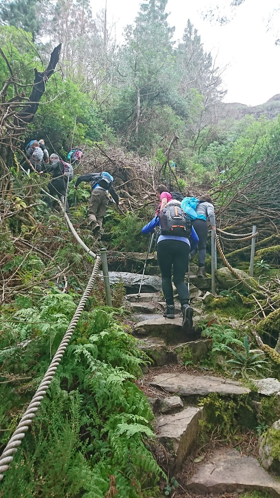
Suitably dressed we set off. Our path took us parallel to the N71,  we crossed it and continued  along a track until we came to a branch to the left. The steps start here.
From here it's practically straight up the north face of Torc Mt. , through woodland and rhododendrons. Behind us views of Kilarney's lakes opening up. Up & up the steps went, we pondered why we didn't take the second option , maybe we had made the wrong decision. As our lungs and legs ached. Still like the British & Brexit, even though we had doubts about our choice we ploughed on

Eventually the steps gave way to some level ground and we veered west. We met some more steps but then we continued down hill.  One thing about the Cardiac Steps route is that you loose most of your hard won altitude. When we turned south at the side of the mountain we were met with a fairly strong headwind. We continued along the old Kenmare road in the valley between Mangerton and Torc. Mangerton was shrouded with fog. Reaching the path to the right for Torc we regrouped. It was somewhat colder now so we put on an extra layer.
The path up the south flank of Torc is mostly sleepered. Below us the Old Kenmare road snakes through through the valley.
Finally we reached the summit at 535 meters. There was a sharp breeze, so we found some shelter.

Here we had refreshments. Thick fog was blowing, but occasionally the veil would lift slightly to offer tantalizing views of the lakes and the Black Valley. Torc Mountain is part of the Mangerton range. As any one from Kanturk area would know Torc means boar. Legend has it that Finn killed a boar with a golden spear on the mountain. We retraced our steps.


We turned right crossing the Owengarriffe river. Down we went with the river tumbling through the undergrowth below us to our left. Torc Waterfall came into view with the usual gaggle of tourists. Eventually we reached the car park.  It was a good day out and the weather held up. Nice to see such big group out. Young and young at heart... Rugby and Soccer matches on TV meant that people were anxious to get home so the usual tea / coffee was not really an option.


  “Walk as if you are kissing the Earth  with your feet “ .......Thich Nhat Hanh


Comments

Popular posts from this blog

The Claragh Loop

 The Claragh Loop is a great walk in North West Cork near Millstreet,   for our Club and our members it is not that far away and in some ways for us it is so close most people never bother doing it, thinking the far away fields are greener.  We use it as a Club Walk once a year but our members often use it go for a walk by themselves or in a small group regularly just to get out for a bit of fresh air or excercise.   To get there you go into Millstreet, turn down the road between Centra & the Church and travel out the Clara Rd. going past the turn off for the Mount Leader Industrial Estate for about a mile until you meet a Grotto and just beyond this you park on the right on the bend. If it is busy around here you may have to go back down to the Clara Rd. and walk back up,  You then proceed to walk up the small road on the town side of where you are after parking until you meet the entrance into the forest on your right . This is the start of the Claragh Loop.You then proceed up

St. Finbars Pilgrim Route -Kealkill To Gougane Barra

On Sunday 8th April the club walk was the Kealkill to Gougane Barra section of the Saint Finbarr’s Way. After leaving town at 09.15 we made our way to Gougane Barra, where we had coffee and left a car with our change of clothes. We then continued to Kealkill to begin our walk. As it was Pilgrim Path week the car park was full so we had to park in the village. We started at Carriganass  ( Rock of the waterfall ) Castle. This castle was an outpost of Donal Cam O’Sullivan Beare. After the battle of Kinsale in 1602, having lost control of his strongholds in Dunboy and Dursey. He led his band of 1000 followers past this castle in mid winter, on a tragic journey to Leitrim. Attacked by both Irish and English on the way only 35 arrived in Leitrim 14 days later. We continued up the road past the castle climbing all the way. After after a little Bantry Bay can be seen.  Two and a half kilometers later we leave the road crossing a stile on our left, climbing steeply towards Knockbreteen hi

Cumeengeera Horseshoe

Now that my biro has dried out the blog can finally be written. On Saturday 15 Sept. the club had originally planned to do the Gougane Barra loop,however it was changed to the Cumeengeera Horseshoe route. This is in the rugged Beara peninsula bordering Cork and Kerry. We set off westwards towards Kenmare on a dry morning. Arriving in Kenmare we stopped for tea / coffee, before heading through Lauragh and to the start of the hike at Shronebirrane stone circle. This is at the head of Rabach’s glen.  Called after Cornelius “Rabach” o Sullivan. Rabach means violent in Irish and Con earned his nickname well. In 1800 he murdered a sailor who called to his door one bad stormy wet night looking for shelter. He later murdered a woman who had witnessed the crime and had threatened to inform the police. Eventually he was caught and hanged in Tralee Gaol in 1831.... We climbed the Horseshoe in an anti clockwise direction. The weather was excellent but the climb was a thigh burning slog to reach t