
Galtymore

On Sunday 22/04 we headed East to the Galty Mountains for the club walk. We left town at 09.00 and continued on to Kings yard, which was the starting point of our climb. The Galty mountains traverse the Limerick Tipperary border and run from East to West. At 919 meters Galtymore is the highest inland mountain in Ireland.
Leaving Kings yard we headed North East to link up with the Black road. On the slopes to our left there appeared to be some evidence of “lazy beds” which were used in the growing of potatoes before the great Famine of 1845. It would also appear that the mountain was home to a good number of people in the past, judging by the number ruins on its slopes.
Reaching the Black road we went north along the track.Conditions were excellent for walking and we made steady progress. It was a very gradual ascent. There were great views southward to the Knockmealdowns. In the distance the the rounded summit of Galtymore our destination loomed ahead. Reaching a cairn it was decision time. Would we continue on and go to Galtybeg first, or turn left and go to straight to Galtymore. It was decided to keep left, conditions underfoot now detoriated and it got boggy. We set our course for the coll between Galtybeg and Galtymore. The hard slog was from here to the summit.  However the views more than made up for it. Over looking Lough Diheen at the bottom of a sheer cliff. Across the way we could see a fairly large town,  which I can now identify as Tipperary town. The village of Bansha could also be seen.
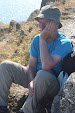
Finally reaching the summit we stopped in the shelter of some rocks and had a welcome bite to eat, and took some photographs.
Very soon a band of thick cloud enveloped us and it got bitterly cold, with a cutting breeze. We decided not to hang around and made our descent.
As we got lower down the weather improved. Is is a pretty steep descent and care is needed, the knees were feeling the pinch.

Reaching the Attychraan river we rested up and admired the waterfalls. There are the remains of an old settlement here. Also in a hollow of a tree is a notebook where hillwalkers write a few lines. Like a version of a visitors book.  We recorded the club name and date of visit. Following the river we made our way to Kings yard. Here we changed and headed to the Firgrove in Mitchelstown for food and to chat about the day. It was a great days walking and good to see a new member, and welcome back an old one....


      “There are no shortcuts to any place worth going “ ............Beverly Sills

Comments

Popular posts from this blog

The Claragh Loop

 The Claragh Loop is a great walk in North West Cork near Millstreet,   for our Club and our members it is not that far away and in some ways for us it is so close most people never bother doing it, thinking the far away fields are greener.  We use it as a Club Walk once a year but our members often use it go for a walk by themselves or in a small group regularly just to get out for a bit of fresh air or excercise.   To get there you go into Millstreet, turn down the road between Centra & the Church and travel out the Clara Rd. going past the turn off for the Mount Leader Industrial Estate for about a mile until you meet a Grotto and just beyond this you park on the right on the bend. If it is busy around here you may have to go back down to the Clara Rd. and walk back up,  You then proceed to walk up the small road on the town side of where you are after parking until you meet the entrance into the forest on your right . This is the start of the Claragh Loop.You then proceed up

St. Finbars Pilgrim Route -Kealkill To Gougane Barra

On Sunday 8th April the club walk was the Kealkill to Gougane Barra section of the Saint Finbarr’s Way. After leaving town at 09.15 we made our way to Gougane Barra, where we had coffee and left a car with our change of clothes. We then continued to Kealkill to begin our walk. As it was Pilgrim Path week the car park was full so we had to park in the village. We started at Carriganass  ( Rock of the waterfall ) Castle. This castle was an outpost of Donal Cam O’Sullivan Beare. After the battle of Kinsale in 1602, having lost control of his strongholds in Dunboy and Dursey. He led his band of 1000 followers past this castle in mid winter, on a tragic journey to Leitrim. Attacked by both Irish and English on the way only 35 arrived in Leitrim 14 days later. We continued up the road past the castle climbing all the way. After after a little Bantry Bay can be seen.  Two and a half kilometers later we leave the road crossing a stile on our left, climbing steeply towards Knockbreteen hi

Cumeengeera Horseshoe

Now that my biro has dried out the blog can finally be written. On Saturday 15 Sept. the club had originally planned to do the Gougane Barra loop,however it was changed to the Cumeengeera Horseshoe route. This is in the rugged Beara peninsula bordering Cork and Kerry. We set off westwards towards Kenmare on a dry morning. Arriving in Kenmare we stopped for tea / coffee, before heading through Lauragh and to the start of the hike at Shronebirrane stone circle. This is at the head of Rabach’s glen.  Called after Cornelius “Rabach” o Sullivan. Rabach means violent in Irish and Con earned his nickname well. In 1800 he murdered a sailor who called to his door one bad stormy wet night looking for shelter. He later murdered a woman who had witnessed the crime and had threatened to inform the police. Eventually he was caught and hanged in Tralee Gaol in 1831.... We climbed the Horseshoe in an anti clockwise direction. The weather was excellent but the climb was a thigh burning slog to reach t