Our Trip To Caherbanagh


Today on our third trip of 2016 we went to Caherbanagh. We did it earlier as our last trip of the year 2015 in very bad weather conditions. This time we were more lucky - no rain and the top covered with soft fresh snow.


Caherbanagh is a mountain which lies between The Paps and Clara, or otherwise down in the flatlands between Rathmore and Millstreet above Ballydaly. Caherbanagh also lies very close to the Kerry county bounds.

Today we had 10 in the group with the usual of Anna, Padraig, Jer, Sheilanne, Bernie, Denis who brought his daughter with him, Celina plus a few new and welcome recruits in Geraldine, Nuala and Margaret.

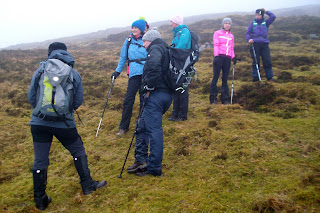
We set out to do the complete Loop of Glanaprehane and Caherbanagh at about 10 am. Off we set and the first part was to climb to our right which today was tough - wet and slippy, until we reached snow-covered part nearer the top and then the higher we went the deeper the snow got but certainly not enough to stop us in our tracks. We got to the top of the Plateau and the next pat was level enough all the way around the loop.

Group photo at the top of Caherbarnagh

Coronation Of The President Of Kanturk Hillwalkers & Mountain Climbers ;)

After a short break for a few photos at the top off we strolled again to our eating point which was a well sheltered spot. After the grub we descended away down and as we did so the skies were starting to clear on all sides of us. By this time the top was clear and in front of us the valley and as always spectacular view of Duhallow and Kerry to our West
.


We descended safely but had to watch our steps as it was slippy, finally back to the cars to refresh and decided to call to The Wallis Arms in Millstreet for a little something and a chat. 


Comments

Popular posts from this blog

The Claragh Loop

 The Claragh Loop is a great walk in North West Cork near Millstreet,   for our Club and our members it is not that far away and in some ways for us it is so close most people never bother doing it, thinking the far away fields are greener.  We use it as a Club Walk once a year but our members often use it go for a walk by themselves or in a small group regularly just to get out for a bit of fresh air or excercise.   To get there you go into Millstreet, turn down the road between Centra & the Church and travel out the Clara Rd. going past the turn off for the Mount Leader Industrial Estate for about a mile until you meet a Grotto and just beyond this you park on the right on the bend. If it is busy around here you may have to go back down to the Clara Rd. and walk back up,  You then proceed to walk up the small road on the town side of where you are after parking until you meet the entrance into the forest on your right . This is the start of the Clar...

St. Finbars Pilgrim Route -Kealkill To Gougane Barra

On Sunday 8th April the club walk was the Kealkill to Gougane Barra section of the Saint Finbarr’s Way. After leaving town at 09.15 we made our way to Gougane Barra, where we had coffee and left a car with our change of clothes. We then continued to Kealkill to begin our walk. As it was Pilgrim Path week the car park was full so we had to park in the village. We started at Carriganass  ( Rock of the waterfall ) Castle. This castle was an outpost of Donal Cam O’Sullivan Beare. After the battle of Kinsale in 1602, having lost control of his strongholds in Dunboy and Dursey. He led his band of 1000 followers past this castle in mid winter, on a tragic journey to Leitrim. Attacked by both Irish and English on the way only 35 arrived in Leitrim 14 days later. We continued up the road past the castle climbing all the way. After after a little Bantry Bay can be seen.  Two and a half kilometers later we leave the road crossing a stile on our left, climbing steeply towards Knockb...

Mangerton & the Devils Punch Bowl June 2019

On Sunday 16 June 2019 the club walk was the Devil’s Punchbowl circuit in the majestic Mangerton mountain range.Mangerton is the only mountain visible from the Main Street in Killarney. We left town at 08.30 and travelled west. The day was dry and sunny. The forecast was for showers at 12.30. We arrived at the starting point and geared up. Initially we walked on level wet ground through Cormicks haggard which was the site of a famous battle in 1262 when the McCarthys halted the Norman invasion into the kingdom. We continued southwards up the northern slopes of Mangerton at a brisk pace now gaining altitude. To our right the lakes were spread out below. With Killarney off in the distance. Underfoot conditions were reasonably good and we made steady progress. Stopping now and then to admire the views , and give our lungs a chance. Soon the terrain leveled off and we contoured south west for a while. We then veered south to bring us to approx mid way above the Devil’s Punchbowl. A sti...